ADK Collectibles

Lumbering Map - Map of Township 40/1900 and Map of the Adirondack Forest Preserve/1900
- Item Number
- 584
- Estimated Value
- 100 USD
- Sold
- 45 USD to nhbcb3fd5
- Number of Bids
- 3 - Bid History
Item Description
Straight from ADK's archives
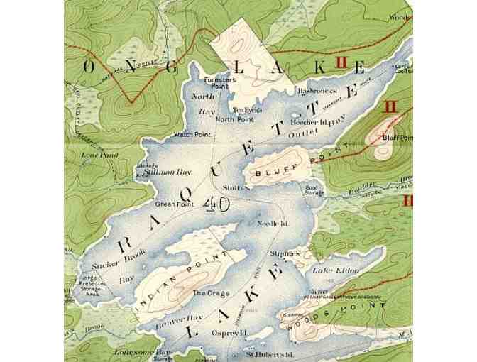
Map of Township 40. Totten & Crossfield Purchase. Hamilton County, N.Y. 1900. Compiled and drawn from U.S. Geological Survey Maps and Reconnoissance by H.S. Meekham. 21 1/2" width by 23" height.
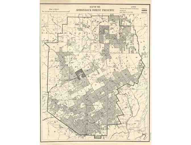
Map of the Adirondack Forest Preserve. Legend. Proposed Adirondack Park Boundary. Township 40. Lands owned by the State. 1900. 8 1/2" width by 11" height.
Donated By:
Adirondack Mountain Club stores data...
Your support matters, so Adirondack Mountain Club would like to use your information to keep in touch about things that may matter to you. If you choose to hear from Adirondack Mountain Club, we may contact you in the future about our ongoing efforts.
Your privacy is important to us, so Adirondack Mountain Club will keep your personal data secure and Adirondack Mountain Club will not use it for marketing communications which you have not agreed to receive. At any time, you may withdraw consent by emailing Privacy@frontstream.com or by contacting our Privacy Officer. Please see our Privacy Policy found here PrivacyPolicy.
 Carl Heilman II, Wild Visions, Inc.
 Trampoline Design
 Louise Finlayson, Ph. D.