Antiques

Large Antique Relief Map of North America, circa 1899
- Item Number
- 1064
- Estimated Value
- 120 USD
- Sold
- 60 USD to MUMMUMM
- Number of Bids
- 1 - Bid History
Item Description
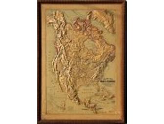
We have a set of antique relief maps from 1899, one is South America, and the other North America. This item is North America's map.
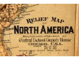
They were made by Central School Supply House, of Chicago, a well known globe and map maker in the late 1800's. The relief is high and bold, and major, and minor, cities, rivers, lakes, mountain ranges, and landmarks are indicated. Also indicated are the bay and inlet names. These maps are quite rare and hard to come by, and are a true collector's item.
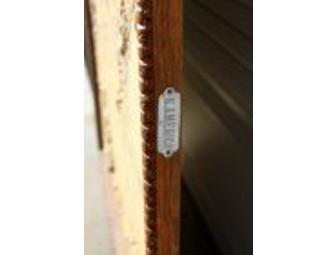
Both maps have identical, original wood frames and metal plaques, and measure 34" x 48".
They likely taught your Great Grandparents their geography lessons!
*This map back shows some water damage, mostly on the back; but upon closer examination, some is also slightly visible on the front around the top of the map near the frame edge. None is on the relief part. There was also a repair made to in the upper right section from a small puncture, but the repair is good, and not very noticeable at all. We will try to provide macro shots of this damage.
Item Special Note
Shipping is charged at actual cost, and added to the purchase price.
Donated By:
Diane Greenough
United Animal Friends stores data...
Your support matters, so United Animal Friends would like to use your information to keep in touch about things that may matter to you. If you choose to hear from United Animal Friends, we may contact you in the future about our ongoing efforts.
Your privacy is important to us, so United Animal Friends will keep your personal data secure and United Animal Friends will not use it for marketing communications which you have not agreed to receive. At any time, you may withdraw consent by emailing Privacy@frontstream.com or by contacting our Privacy Officer. Please see our Privacy Policy found here PrivacyPolicy.