Outdoor Gear
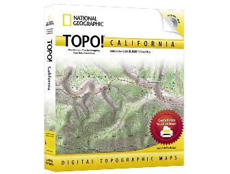
TOPO! California
- Item Number
- 138
- Estimated Value
- 50 USD
- Opening Bid
- 25 USD
Item Description
TOPO! State Series – National Geographic’s best selling, top-of-the-line, digital map software is the easiest way to create & print detailed maps. Each program includes 1,000’s of the highest quality USGS topographic maps, optimized for printing and ease of use.
TOPO! gives you five levels of map detail, from two National Geographic Atlas maps to a USGS 1:24,000 scale (7.5’) seamless topographic map – the most detailed outdoor recreation maps available. Maps include:
• (2) National Geographic Atlas Maps
• USGS 500,000 Scale Maps – Highlights public lands
• USGS 100,000 Scale Topographic Maps – Mid-Scale topos perfect for long trips
• USGS 24,000 Scale Topographic Maps – The most detailed terrain maps available
With TOPO!’s dynamic search features, you can quickly find your area of interest. Or simply browse the map to locate your desired destination.
TOPO! maps are full color, high resolution scans of authentic USGS topographic maps, providing the best image quality available. All maps are seamless, and easily printed from your home printer. Paired with National Geographic AdventurePaper, our waterproof, tear-resistant material, your maps become trail-tough.
TOPO! is the easiest way to tell your GPS where to go. Simply trace your route and upload to your receiver. Use in reverse to create detailed trail maps from your adventures.
Packed with Additional Features
From creating custom map to viewing detail elevation profiles and connecting to your GPS, TOPO! is loaded with enhanced mapping tools to get you where you need to go.
• Create your perfect map - Add routes, symbols, photos & notes.
• Communicate with our GPS - Transfer routes, waypoints, and tracks.
• Explore in 3D – See you route via a 3D fly-through.
• Profile Your Route – Survey distances, elevations, and more.
• Search for Destinations – Find trails, parks, campsites, and more.
Plus with TOPO! You Can:
• Print oversized maps
• Import Geocaches and GPX files
• Export detailed maps to other programs
• Stay current with easy and automatic LiveMap updates
Item Special Note
Minimum System Requirements:
Windows 7, Vista, XP, 2000, ME, NT or 98. Pentium processor or better, 64 MB RAM + 8MB video memory, DVD drive, Macintosh OS 10.4 or higher, 350MHz G3 or better, 128 MB RAM + 16 MB video memory, DVD drive
Supported GPS Receivers:
Works with most popular handheld receivers from Garmin, Magellan, Lowrance and Eagle. Enables import and export of routes, waypoints and track information. – DOES NOT support direct map transfer to any GPS except select Magellan GPS units. Visit www.natgeomaps.com/gps for a complete list of compatible GPS receivers.
Donated By:
Association of Partners for Public Lands stores data...
Your support matters, so Association of Partners for Public Lands would like to use your information to keep in touch about things that may matter to you. If you choose to hear from Association of Partners for Public Lands, we may contact you in the future about our ongoing efforts.
Your privacy is important to us, so Association of Partners for Public Lands will keep your personal data secure and Association of Partners for Public Lands will not use it for marketing communications which you have not agreed to receive. At any time, you may withdraw consent by emailing Privacy@frontstream.com or by contacting our Privacy Officer. Please see our Privacy Policy found here PrivacyPolicy.


