Maps,Books,Magazines

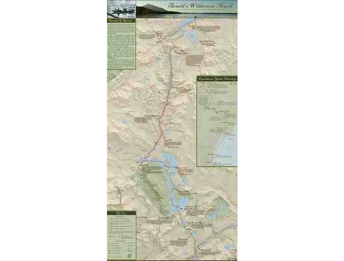
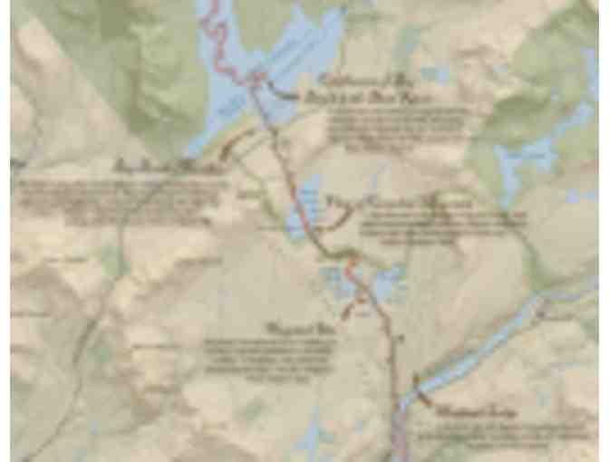
Map of Benedict Arnold's Wildernesss March Through the Northern Forest
- Item Number
- 278
- Estimated Value
- 9 USD
- Sold
- 15 USD to billydue
- Number of Bids
- 4 - Bid History
Item Description
The Arnold Expedition's Route from Kennebec River, Maine to Lac Megantic, Quebec
In the fall of 1775, Colonel Benedict Arnold led a detachment of 1,100 American soldiers through the Maine and Canadian wilderness in what was intended to be a coordinated, secret attack on the British army fortified in Quebec City. This map and guide documents the grueling, 80-mile stretch of rivers, ponds and portages that the Arnold Expediation traversed between the Great Carrying Place of the Kennebec River and Lac Megantic at the start of the Chaudiere River.
Use this 18" x 36" map and guide (great as a poster too!) to visualize the hardships that the expedition faced and discover opportunities to follow in Arnold's footsteps and paddle strokes.
Item Special Note
Shipping: Ships from NFCT office.
Donated By:
Northern Forest Canoe Trail stores data...
Your support matters, so Northern Forest Canoe Trail would like to use your information to keep in touch about things that may matter to you. If you choose to hear from Northern Forest Canoe Trail, we may contact you in the future about our ongoing efforts.
Your privacy is important to us, so Northern Forest Canoe Trail will keep your personal data secure and Northern Forest Canoe Trail will not use it for marketing communications which you have not agreed to receive. At any time, you may withdraw consent by emailing Privacy@frontstream.com or by contacting our Privacy Officer. Please see our Privacy Policy found here PrivacyPolicy.