Home

Raised Relief Map
- Item Number
- 102
- Estimated Value
- 32 USD
- Sold
- 29 USD to cd178aff5
- Number of Bids
- 4 - Bid History
Item Description
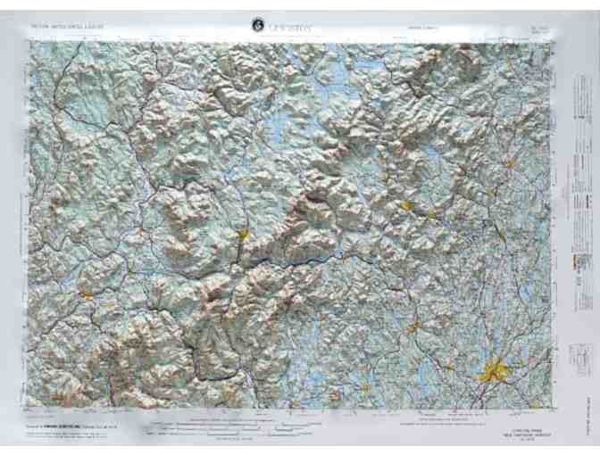
This 3-dimensional USGS topographic map covers 2° longitude and 1° latitude. That is about 100 miles east to west and 70 miles north to south. Geographically this covers from approximately St. Johnsbury to the west, Mount Moosilauke to the south Lewiston to the east and Saddleback Mountain to the north. Bethel sits almost in the middle so this map provides excellent coverage of the geographic gems in our backyard including the Appalachian Trail.
The maps use shaded relief and are a wonderful visual reference. They are appropriate for real estate offices, travel agencies, outdoor enthusiasts and classroom use. Each map is approximately 21" high by 31" wide
How it is done:
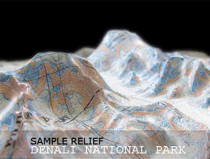
We begin with a flat map printed on sturdy vinyl. We then construct a terrain model using digital elevation data from the USGS and other sources. The vinyl map is carefully registered with the terrain mold. Once the registration of the map is complete, it is vacuum formed over the terrain model. The result is a truly exceptional visual and tactile reference. You will be proud to display one of our raised relief maps in any setting.
Item Special Note
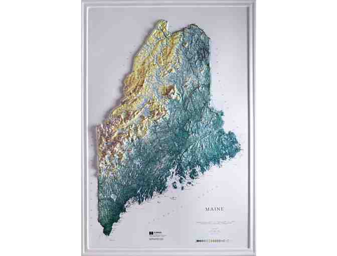
Winning bidder can choose the regional map described above or a map of the whole state of Maine. Map is provided unmounted. Upgrade to a map mounted in a black plastic frame for an additional $25 or to an oak frame for an additional $50.
True North Adventureware is a local outdoor shop offering quality brand clothing, footwear, gear, accessories, and gifts for everyone from the technical adventurer to the armchair enthusiast. Snowshoe rentals and swimsuits. Open daily year round.
Donated By:

Bethel Area Chamber of Commerce stores data...
Your support matters, so Bethel Area Chamber of Commerce would like to use your information to keep in touch about things that may matter to you. If you choose to hear from Bethel Area Chamber of Commerce, we may contact you in the future about our ongoing efforts.
Your privacy is important to us, so Bethel Area Chamber of Commerce will keep your personal data secure and Bethel Area Chamber of Commerce will not use it for marketing communications which you have not agreed to receive. At any time, you may withdraw consent by emailing Privacy@frontstream.com or by contacting our Privacy Officer. Please see our Privacy Policy found here PrivacyPolicy.