Art
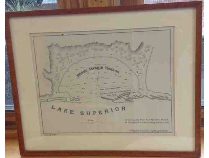
Antique Map of Grand Marais, Framed
- Item Number
- 268
- Estimated Value
- 150 USD
- Sold
- 60 USD to jbb51fda2
- Number of Bids
- 3 - Bid History
Item Description
One-of-a-kind framed antique map of the Grand Marais Harbor.
Lake Superior Indians recognized the unique nature of this bay long ago, naming it the "Kitchi-Bitobig," meaning, "double body of water." When white man first settled around this bay, in 1854, a few Indian families lived in tepees and cabins around the shore. White population increased rapidly after the 1870s, and dependence on ship transportation became more critical. Storms and shipwrecks led to demands for a lighthouse, which was finally built in 1885, the first on the American North Shore. As added protection for this harbor of refuge, the east breakwater had been built a year earlier; the harbor became even more protected from violent seas in 1901, when Corps of Engineers completed the west breakwater and continued the 16-foot dredging project. During three generations, this bay was a busy hub of economic and social activity: commercial fishing, shipping and rafting sawlogs and pulpwood, dredging gravel, picnics and bonfires on the point, 4th of July celebrations, skating and swimming, sailboat races, the arrivals and departures of the steamships "Dixon" and "America" and many other vessels. Until the new highway along the North Shore was built in the 1920s, this magnificent harbor was the focus of life in Grand Marais.
Frame measures 14" x 11".
Item Special Note
Winning bidder is responsible for picking up the frame at North House Folk School or for shipping costs.
Donated By:
Dale and Susan Amondson
NORTH HOUSE FOLK SCHOOL stores data...
Your support matters, so NORTH HOUSE FOLK SCHOOL would like to use your information to keep in touch about things that may matter to you. If you choose to hear from NORTH HOUSE FOLK SCHOOL, we may contact you in the future about our ongoing efforts.
Your privacy is important to us, so NORTH HOUSE FOLK SCHOOL will keep your personal data secure and NORTH HOUSE FOLK SCHOOL will not use it for marketing communications which you have not agreed to receive. At any time, you may withdraw consent by emailing Privacy@frontstream.com or by contacting our Privacy Officer. Please see our Privacy Policy found here PrivacyPolicy.

