Antiques

Antique Wall Map of the United States and Territories, 1870
- Item Number
- 236
- Estimated Value
- 500 USD
- Sold
- 150 USD to bdaeaa01e
- Number of Bids
- 1 - Bid History
Item Description
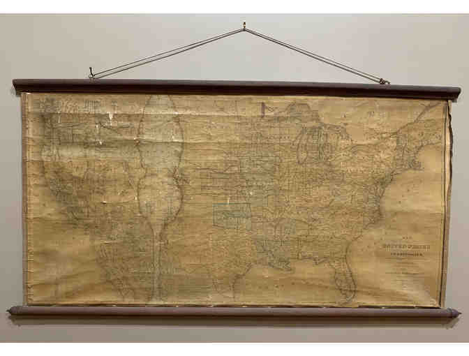
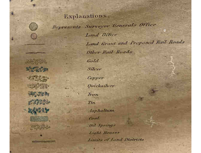
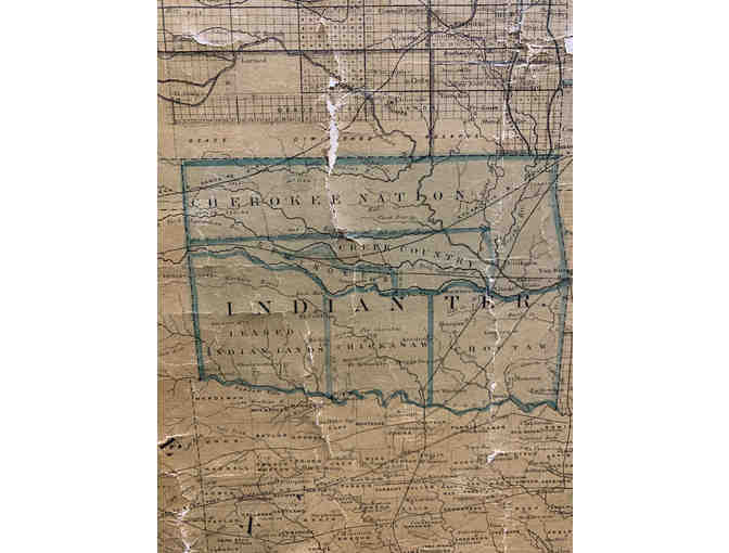
Incredible antique Map of the United States and Territories, 1870
Showing the Extent of Public Surveys and Other Details, Constructed from the Platts and Official Sources of the General Land Office Under the Direction of the Hon. Jos. S Wilson
Shows locations of oil springs, gold, silver, and other metals
42" x 48", a few tears and wear
Item Special Note
Must be picked up at the Adirondack History Museum or added shipping charges
Adirondack History Museum stores data...
Your support matters, so Adirondack History Museum would like to use your information to keep in touch about things that may matter to you. If you choose to hear from Adirondack History Museum, we may contact you in the future about our ongoing efforts.
Your privacy is important to us, so Adirondack History Museum will keep your personal data secure and Adirondack History Museum will not use it for marketing communications which you have not agreed to receive. At any time, you may withdraw consent by emailing Privacy@frontstream.com or by contacting our Privacy Officer. Please see our Privacy Policy found here PrivacyPolicy.