Home

Adirondack Park Map
- Item Number
- 107
- Estimated Value
- 40 USD
- Sold
- 65 USD to MrsTrump
- Number of Bids
- 11 - Bid History
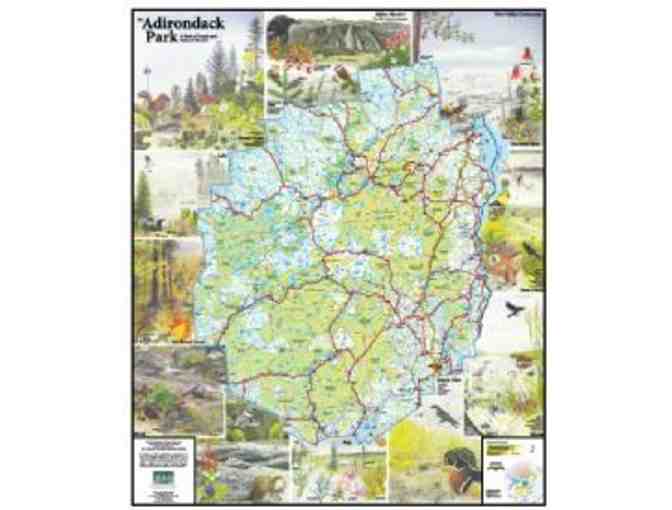
Item Description
Laminated Adirondack Park Map (35" x 43") showing public and private lands, wilderness areas, mountains, rivers, towns and highways. The map is bordered by beautiful detailed watercolor illustrations by renowned Adirondack artist, the late Anne E. Lacy, depicting various habitat found in the Adirondacks: alpine meadow, river valley, marsh, bog, river, brook, hardwood forest, lake, and boreal forest.
This is the 2nd edition of the Adirondack Council's map. This version reflects the addition of almost 70,000 acres of public land since the first edition was released in 1994.
Adirondack History Museum stores data...
Your support matters, so Adirondack History Museum would like to use your information to keep in touch about things that may matter to you. If you choose to hear from Adirondack History Museum, we may contact you in the future about our ongoing efforts.
Your privacy is important to us, so Adirondack History Museum will keep your personal data secure and Adirondack History Museum will not use it for marketing communications which you have not agreed to receive. At any time, you may withdraw consent by emailing Privacy@frontstream.com or by contacting our Privacy Officer. Please see our Privacy Policy found here PrivacyPolicy.